
Text 7B
Changes in Russian Cadastre
An epoch of Peter I is a turning point in the Russian history. But the character of the changes is more difficult to be defined. The wellknown view of Petеr’s reign as westernization, the turn from Asian, stagnant, introspective Moscow Rus towards the Europe of the New Ages does not reflect the whole picture. The European influence was great indeed, but something in the nature of the Russian state the Great Reformer left does not allow considering it European in full sense of the word.
The historical studies at the beginning of the XXI st century showed that there had been much in common between the social institutions of Middle Ages Moscow Rus and Western Europe, especially in the social organization of rural parish. Russian philosophers of the XIX th century stated that a totally original character of pre-Petrine Russian culture, society and state had greatly differed from the European ones. The reasons for it can be seen either in endless forestry plains of ancient Russia or in specific character of Orthodox faith.
The first Emperor of Russia had been responsible for the start of magnificent projects of state building, imperial ideology and merciless way of bringing all this into practice. Some authors tried to justify the cruel methods, which were too well known to him. Such interpretation of the history was more or less appreciated by the official ideology.
One could understand the desire to reexamine the epoch of Peter the Great today, when the same facts could be seen as different in the mirror of current changes in Russia. Certainly, the historical facts of this period had been already carefully studied, though important archival documents and facts could be discovered yet.
Comparing the Russian cadastral surveys of the XVI-XVII th centuries with those of the XVIII th century one can follow the changes in the nature and purposes of the cadastre. The XVI-XVII th centuries «pistsovye knigi» have changed into documents and maps of land and forest cadastres and few other geographical surveys of cadastral character in the XVIII-th century.
Land tax had been replaced with poll tax. Despite this old feudal system remained untouched and the Moscow government continued to collect statistical descriptions of its principality in order to check the
71
fulfillment of vassals dues and for distribution of empty lands. The last important action of the Administration of Estates of that period had been the Total Bordering (Valovoie Mezhevanie) which examined all administrative units of contemporary Moscow tsardom. For the first time the aim was set of state bordering and not only of measuring. It was connected with transformation of farming system with the stable borders of parcels and estates. At the same time this aim showed the new level of geographical knowledge and demand.
17. Прочтите текст 7С, переведите его и раскройте содержание рассматриваемых в нем проблем.
Text 7C
Peter’s reforms
Before Peter the Great land relations in the Moscow state did not lose its feudal nature. It means tight mutual dependence of central government, peasantry, aristocracy, nobility, dependence of Moscow from the economic development of the territories and prosperity of all estates, elements of self-governing of administrative units. A kind of legal treaty between the tsar and landlords formed the basement of the civil and military service and financial system. All this is an indirect evidence of classes representative system – a kind of feudal «democracy». This was the system replaced by the tsar-reformer.
Peter’s reforms meant the end of the old order. State building projects of Peter I, his political and economic projects, building of navy and re-organization of the army, mining and industry development, studying of the natural waterways and projects of channels – all this caused the centralization of power, unknown before. The old order of state and military service were unable to satisfy the growing demands for qualified and numerous authorities corresponding to the complexity of the aims of the reign. But one of the main things was the impossibility of feudal system to answer the increasing demand for civil and military staff due to the decreasing land resources, which served as the «payment» for state service earlier. Politically weak vassal and tax classes were unable to resist the energy of the tsar.
The state economy, pressed by necessity of urgent changes, increased day by day. Practically all economic projects (including military) had been based on the rich resources belonging to the state or
72
quasi-state enterprises with forests, mines and slaves enclosed to them, such as baron Stroganov’s tremendous estate in Siberia or — some time later – Demidov’s iron plants in Ural mountains. The demand for natural resources was growing constantly. The forests were to satisfy the needs of navy and metallurgic industry, peasantry should also serve as a resource for magnificent state building. Peter’s conception of modernization did not care about the majority of Russians. The rights of the classes had been strongly restricted, the basement of common rights regulating the relations between vassals and supreme power decreased. The development of serfdom and growing pressure of peasant commons against the individuals is often seen as the result of Peter’s reform.
It is obvious that Peter’s reforms have raised from the urgent demands of state management during the war. Peter I had no definite concept of «westernization». One can hardly believe that this practi- cally-minded man could be interested in the largely abstract ideas of introducing the foreign culture as well as different social, administrative and management methods.
18. Прочтите и письменно переведите на русский язык текст 7Д.
Text 7D
Forest Cadastre
One can see on the example of the forest cadastre that foreign methods introduced in Russia developed not only in the different social and cultural context, but even in the administrative and management environment.
Navy building had been one of the main priorities of Peter I reign. The regular forest surveys were ordered in 1703. Soon all the timber forests of European Russia — from the Baltic Sea to the Volga were managed by the Admiralty. It meant not only the forests of the crown but also private, common and clergy forests. It became illegal to the owners to cut their timber if not suitable for the navy. The historiographer of the Ministry of State Property Lev Zakharov considers it to be
73
the nationalization of forest resources. Only at the reign of Ekaterina II liberalization of the forest status took place and in 1802 Forest Department became the body of the Ministry of Finances.
All the timber forests were examined and mapped by the officers. All the oaks, lime-trees and pines were counted and measured. It was a forest doomsday indeed. Hundreds of large-scale maps and charts, accompanied with tabular statistics were prepared. Later these documents served as the source for general forest atlases such as wellknown «General Atlas of various kinds of forests» from the Hermitage Collection of Manuscript Department of the National Library in Petersburg. These surveys were carried out even where forests were never used later.
The fact that forest surveys were surprisingly detailed and exact so deserved special attention. Taking into consideration that large-scale mapping had been new in the practice of Russian state management, we could see the importance of forest surveys for Peter’s administration. It makes clear the great shipbuilding plans of Admiralty and Peter himself, this «Sailor and carpenter», as he was called by Pushkin. The mapped resources of timber forests were much more than the real forest consumption and shipbuilding had ever been at that time or later.
The technology of the forest mapping is well known. It was largely borrowed from the western mapmaking. The aim of Peter’s cadastres – navy building – is similar to the one of Colbert’s, who managed the French crown estates at the same way. But if the Colbert cadastres managed only forests of the crown, all the Russian forests in practice belonged to the crown for almost a century after implementation of Peter’s cadastre. This nationalization seems to have nothing in common with European management of natural resources.
Land cadastres could be opposed to the forest ones. Highly developed in the XVI-XVII th centuries, it degraded during Peter’s reign. The reason for it was not the tax reform, but the transformation of feudal state into highly centralized bureaucratic system. Regular land surveys did not take place any more despite the fact that landed nobility remained the source for recruiting military and civil statesmen. The land property of nobility giving them independence was considered as an obstacle to their state service. The implementation of obligatory
74
strict forms of state service for nobility is a confirmation of this statement.
Despite the large map surveys of Peter’s geodesists in the internal provinces of Russia, where most of land estates were situated, these maps do not reflect land property rights, as well as land use and evaluation. These documents are similar to the later surveys of Russian frontier and colonial territories of Crimea, Siberia, Mid-Asia. The main aim of those is the use of maps for the effective state management and the search for additional natural resources.
The emergence of «resource» paradigm in Russian geography and implementation of resource cadastres instead of tax ones is the result of Peter’s modernization. For long time till now these traits of Russian geographical knowledge remained linked with the active reforms carried out by the central power. Though the scientific basis of forest cadastre of Peter I – the most remarkable of his cadastres – had been borrowed from the European science, this stresses the original way of natural resources management.
75
Lesson 8. CADASTRAL AND LAND REGISTRATION
SYSTEMS IN EUROPE
1. Прочтите следующие слова:
Methodically, colleagues, boundary, certain, majesty, zoom, announce, complete, widespread, digital, session, authority, Gazeteer, consequence, emerge, arrange, aforementioned, validity.
2. Прочтите и переведите следующие группы слов:
Within a certain country; use and implementation throughout Europe; to maximize the efficiency; Valuation Office Agency; complete digital database; e-Business strategy; relatively uniform cadastral surveys; unique definition; certificate of title; less pronounced; must be surveyed and demarcated; objects of taxation; greatest achievements; the cradle of the European cadastre’ under the umbrella.
3. Запомните следующие слова и словосочетания:
aforementioned countries – вышеупомянутые страны agreement (n.) – соглашение, договор
application (n.) – заявление, обращение
assessor (n.) – эксперт, консультант, чиновник, оценщик assign (v.) – определять, предназначать
attain (v.) – достигать, добиваться
bind (bound) (v.) – связывать, ограничивать
76
blow (v.) – дуть
book (v.) – регистрировать, записывать compile (v.) – составлять, собирать conventional (adj.) – условный, традиционный cradle (n.) – колыбель, начало, исток database (n.) – база данных
deadline (n.) – крайний срок, черта, за которую нельзя переходить delay (v.) – задерживать
devolve (v.) – передавать (полномочия, обязанности) doubtful (adj.) – сомнительный
embark (v.) – грузить, вступать emerge (v.) – появляться, всплывать empower (v.) – уполномочивать
endure (v.) – выносить, длиться, продолжаться exert (v.) – напрягать, осуществлять Gazeteer (n.) – географический справочник her majesty – её величество
homogenous (adj.) – одинаковый, однородный identical (adj.) – идентичный, одинаковый impelling reason – побудительная причина insufferable (adj.) – нетерпимый
insupportable (adj) – невыносимый introduce (v.) – внедрять
inventory of data – опись, инвентаризация, переучет данных jointly (adv.) – совместно
large-scale mapping – крупномасштабное картирование license (v.) – лицензировать
loosely (adv.) – свободно
obstacle (n.) – препятствие, помеха
organizational frameworks – организационные рамки pan (v.) – подготовить, подвергнуть резкой критике pronounce (v.) – заявлять, произносить
recent (adj.) – недавний, последний, современный registrar (n.) – архивариус, регистратор reliability (n.) – надёжность
remain (v.) – оставаться
search (n.) – поиск, исследование similarity (n.) – схожесть
77
trait (n.) – штрих, черта unification (n.) – объединение
uniform (adj.) – однообразный, единый, постоянный verbal description – устное описание
wealth (n.) – благосостояние
widespread (adj.) – широко распространенный zoom (v.) – изменить
4. Прочтите и переведите следующий текст:
Text 8A
The UK «Cadastre»
The word cadastre is generally used to describe «a methodically arranged public inventory of data concerning properties, within a certain country or district, based upon a survey of their boundaries». There are numerous models for its use and implementation throughout Europe. Using the land parcel as its foundation, the cadastre is used to record information about land rights, valuation, land use, etc.
There is no UK Cadastre – the word cadastre is not one commonly used in the UK, where for historical reasons the development of land administration institutions has taken place in a different way from the rest of Europe. While mapping remains the basis for those activities considered as «cadastral», in the UK there is no single organization responsible for the cadastre.
Ordnance Survey, as a national mapping agency, maintains large scale mapping for England, Scotland, and Wales. In Northern Ireland this is the responsibility of Ordnance Survey Northern Ireland. The detailed digital mapping maintained by these two Government Agencies provides the definitive framework upon which other organizations can «book» and manage their data. Another difference with most mainland European countries is that the base mapping in UK is topographic – it shows features that exist on the ground but not the fixed boundary points and monuments usually associated with a cadastre.
Ordnance survey has made Great Britain one of the few countries in the world to have a complete digital national topographic database.
78
It includes complete large scale data for all urban areas. Recently Ordnance Survey Northern Ireland has completed the UK picture with large scale digital data covering the entire province. Within Great Britain there is now widespread use of digital mapping across many user sectors, in one of the most developed markets in Europe.
Over the last twelve months Ordnance Survey has embarked on a number of projects under the umbrella of a new «e-Business strategy», the vision of which is: «Ordnance Survey and its partners will be the content provider of choice for location based information in the new knowledge economy». As a part of its new e-Business strategy, Ordnance Survey is developing its digital mapping products and services within a coherent infrastructure known as the Digital National Framework. A unique 16 digit topographic identifier is used for all points, lines, and areas, and provides a common link that will allow different data to reference the same feature allowing users to cross reference data in a way that should help to release the potential and value of their data.
The Nation Land Information Service (NLIS) is a part of the UK Government «modernizing government» initiative. It is a project being jointly developed by HMLR and Local Government. It features private sector partners that provide access to a National Land and Property Gazeteer.
In conclusion, while there is no cadastre in the United Kingdom the activities normally considered to be a part of the cadastre on continental Europe are performed by a variety of agencies. Although the organizational frameworks are different, many of the issues facing UK institutions are similar to those faced by our colleagues involved in cadastre in other parts of Europe. There is a need to create coordination of efforts in a way described in the UK as «joined-up government» in order to maximize the efficiency of effort and to provide the best value and service to the citizen.
5. Найдите синонимы среди следующих слов:
Reason, need, best, maximize, purpose, necessity, excellent, link, similar, bind, increase, same.
79
6.Образуйте от данных слов антонимы при помощи отрицательных префиксов:
In -: significance, separable, official, subordinate, sufferable, urban(e), appropriate, supportable, dependence, dependant;
Un -: limited, steady, suitable, known, reasonable, thinking, trained, suspected.
7.Переведите следующие сочетания слов с русского на английский язык:
Основная схожесть; несмотря на организационные рамки; правительственные структуры (агентства); картирование остается основой; оценка имущества (недвижимости); электронная бизнесстратегия; уникальный цифровой определить (идентификатор); инициатива модернизации правительства; полевые заметки; в соответствии с количеством участков; «объединенное правительство»; бывшие колонии; степень безопасности и надёжности; он должен обратиться к регистратору.
8. Переведите следующие предложения с русского на английский язык:
1. Важной характерной чертой разработки является связь между кадастром и регистрацией земли. 2. Франция – колыбель (родоначальник) кадастра. 3. Французский кадастр был определен Наполеоном в начале XIX века. 4. В Соединенном Королевстве нет кадастра. 5. В Англии 2 агентства, которые несут ответственность за запись прав на землю. 6. Англия имеет полную цифровую государственную топографическую базу данных. 7. Уникальный топографический определить используется для
80
Соседние файлы в предмете [НЕСОРТИРОВАННОЕ]
- #
- #
- #
- #
- #
- #
- #
- #
- #
- #
- #
From Wikipedia, the free encyclopedia
A cadastre or cadaster is a comprehensive recording of the real estate or real property’s metes-and-bounds of a country.[1][2]
Often it is represented graphically in a cadastral map.
In most countries, legal systems have developed around the original administrative systems and use the cadastre to define the dimensions and location of land parcels described in legal documentation.
A land parcel or cadastral parcel is defined as «a continuous area, or more appropriately volume, that is identified by a unique set of homogeneous property rights».[3]
Cadastral surveys document the boundaries of land ownership, by the production of documents, diagrams, sketches, plans (plats in the US), charts, and maps. They were originally used to ensure reliable facts for land valuation and taxation. An example from early England is the Domesday Book in 1086. Napoleon established a comprehensive cadastral system for France that is regarded as the forerunner of most modern versions.
Cadastral survey information is often a base element in Geographic Information Systems (GIS) or Land Information Systems (LIS) used to assess and manage land and built infrastructure. Such systems are also employed on a variety of other tasks, for example, to track long-term changes over time for geological or ecological studies, where land tenure is a significant part of the scenario.
The cadastre is a fundamental source of data in disputes and lawsuits between landowners.
Land registration and cadastre are both types of land recording and complement each other.[2]

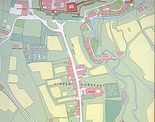
Cadastral map of Bozen, Tirol, Brixner Kreis Nr 1, 1858
Definition[edit]
A cadastre commonly includes details of the ownership, the tenure, the precise location (therefore GNSS coordinates are not used due to errors such as multipath),[4] the dimensions (and area), the cultivations if rural, and the value of individual parcels of land. Cadastres are used by many nations around the world, some in conjunction with other records, such as a title register.[1]
The International Federation of Surveyors defines cadastre as follows:[5]
A Cadastre is normally a parcel based, and up-to-date land information system containing a record of interests in land (e.g. rights, restrictions and responsibilities). It usually includes a geometric description of land parcels linked to other records describing the nature of the interests, the ownership or control of those interests, and often the value of the parcel and its improvements.
Etymology[edit]
The word cadastre came into English through French from the Greek katástikhon (κατάστιχον), a list or register, from katà stíkhon (κατὰ στίχον)—literally, «(organised) line by line».[6]
History[edit]

A cadastre text written in Akkadian on a terracotta tablet. From the 18th century BC in Sippar, Iraq, and held by the Ancient Orient Museum, Istanbul
Cadastre survey marker from the South Tyrol mountains, 2018
Some of the earliest cadastres were ordered by Roman Emperors to recover state owned lands that had been appropriated by private individuals, and thereby recover income from such holdings. One such cadastre was done in AD 77 in Campania, a surviving stone marker of the survey reads «The Emperor Vespasian, in the eighth year of his tribunician power, so as to restore the state lands which the Emperor Augustus had given to the soldiers of Legion II Gallica, but which for some years had been occupied by private individuals, ordered a survey map to be set up with a record on each ‘century’ of the annual rental».[7][8] In this way Vespasian was able to reimpose taxation formerly uncollected on these lands.[7]
With the fall of Rome, the use of cadastral maps effectively discontinued. Medieval practice used written descriptions of the extent of land rather than using more precise surveys. Only in the sixteenth and early seventeenth centuries did the use of cadastral maps resume, beginning in the Netherlands. With the emergence of capitalism in Renaissance Europe, the need for cadastral maps reemerged as a tool to determine and express control of land as a means of production. This took place first privately in land disputes and later spread to governmental practice as a means of more precise tax assessment.[7]
Surveys[edit]
Cadastral surveying is the sub-field of cadastre and surveying that specialises in the establishment and re-establishment of real property boundaries. It involves the physical delineation of property boundaries and determination of dimensions, areas and certain rights associated with properties. This is regardless of whether they are on land, water or defined by natural or artificial features.[9] It is an important component of the legal creation of properties. A cadastral surveyor must apply both the spatial-measurement principles of general surveying and legal principles such as respect of neighboring titles.

Map[edit]
A cadastral map is a map that shows the boundaries and ownership of land parcels. Some cadastral maps show additional details, such as survey district names, unique identifying numbers for parcels, certificate of title numbers, positions of existing structures, section or lot numbers and their respective areas, adjoining and adjacent street names, selected boundary dimensions and references to prior maps.
Documentation[edit]
Cadastral documentation comprises the documentary materials submitted to cadastre or land administration offices for renewal of cadastral recordings. Cadastral documentation is kept in paper and/or electronic form.[10] Jurisdiction statutes and further provisions specify the content and form of the documentation,[11] as well as the person(s) authorized to prepare and sign the documentation, including concerned parties (owner, etc.), licensed surveyors and legal advisors. The office concerned reviews the submitted information; if the documentation does not comply with stated provisions, the office may set a deadline for the applicant to submit complete documentation.[12][13]
The concept of cadastral documentation emerged late in the English language, as the institution of cadastre developed outside English-speaking countries. In a Danish textbook, one out of fifteen chapters regards the form and content of documents concerning subdivision and other land matters.[14] Early textbooks of international scope focused on recordings in terms of land registration and technical aspects of cadastral survey, yet note that ‘cadastral surveying has been carried out within a tight framework of legislation’.[15][3] With the view of assessing transaction costs, a European project: Modelling real property transactions (2001–2005) charted procedures for the transfer of ownership and other rights in land and buildings.[16] Cadastral documentation is described, e.g. for Finland as follows ‘8. Surveyor draws up cadastral map and cadastral documents .. 10. Surveyor sends cadastral documents to cadastral authority.’ [17] In Australia, similar activities are referred to as ‘lodgement of plans of subdivision at land titles offices’ [18]
Management[edit]
Cadastre management has been used by the software industry since at least 2005.[19][20] It mainly refers to the use of technology for management of cadastre and land information in geographic information systems, spatial data infrastructures and software architecture, rather than to general management issues of cadastral and other land information agencies.[15]
United States[edit]
In the United States, Cadastral Survey within the Bureau of Land Management (BLM) maintains records of all public lands. Such surveys often require detailed investigation of the history of land use, legal accounts, and other documents.
The Public Lands Survey System is a cadastral survey of the United States originating in legislation from 1785, after international recognition of the United States. The Dominion Land Survey is a similar cadastral survey conducted in Western Canada begun in 1871 after the creation of the Dominion of Canada in 1867. Both cadastral surveys are made relative to principal meridian and baselines. These cadastral surveys divided the surveyed areas into townships, square land areas of approximately 36 square miles (six miles by six miles; some very early surveys in Ohio created 25 square mile townships when the design of the system was being explored). These townships are divided into sections, each approximately one-mile square. Unlike in Europe, this cadastral survey largely preceded settlement and as a result greatly influenced settlement patterns. Properties are generally rectangular, boundary lines often run on cardinal bearings, and parcel dimensions are often in fractions or multiples of chains. Land descriptions in Western North America are principally based on these land surveys.
See also[edit]
- Assessor’s parcel number
- Boundary (real estate)
- Cadastral community
- Cadastral divisions of Australia
- Defter (Ottoman Empire)
- Estate (house)
- Geographic information system (GIS)
- Kadaster (Netherlands)
- Land administration
- Land (economics)
- Land grant
- Land tenure and registration
- Real property
- Recorder of deeds
- Surveying
- Web mapping
References[edit]
- ^ a b «Cadastral Template — Field Data C4» (lists nations), CadastralTemplate.org, January 2008, webpage: CT-C4 Archived 2012-07-30 at the Wayback Machine: also has term «cadastral survey» and other land records.
- ^ a b Jo Henssen, Basic Principles of the Main Cadastral Systems in the World, [1]
- ^ a b Dale, Peter; McLaughlin, John (2000). Land Administration. Oxford University Press. doi:10.1093/oso/9780198233909.001.0001. ISBN 9780198233909.
- ^ Wormley, Samuel J. «Sam Wormley’s GPS Errors & Estimating Your Receiver’s Accuracy». Archived from the original on 2016-03-10.
- ^ FIG (1995) «The FIG Statement on the Cadastre», FIG Policy Statement, The International Federation of Surveyors (FIG), FIG PUBLICATION No 11, 1995,OCLC 38375638 fig.net
- ^ «Lexico powered by Oxford». Lexico. Dictionary.com and Oxford University Press. Archived from the original on December 30, 2019. Retrieved 30 December 2019.
- ^ a b c Roger J. P. Kain and Elizabeth Baigent (1992). The Cadastral Map in the Service of the State: A History of Property Mapping. The University of Chicago Press.
- ^ Le_cadastre_d’Orange
- ^ Land.Vic (2020-12-18). «Cadastral survey». Land.Vic. Retrieved 2022-04-29.
- ^ «Slovak Geoportal, retrieved 2016-08-02».
- ^ «ČÚZK — Registration into the Cadastre of Real Estate».
- ^ Shala, X., Meha, M. and Ahmedi, S. (2015) Case Study of the Reforms on Laws for the Cadaster in the Republic of Kosovo. FIG Working Week 2015, Sofia, Bulgaria, 17-21 May 2015; retrieved 2016-08-04
- ^
Roşu D. C., Ciolac Valeria, Colţan O. N. (2016) Some aspects of cadastral documentation necessary registration agricultural land in land book Journal of Horticulture, Forestry and Biotechnology 20 (2) 231-233 - ^ Pedersen, V. E. (1951) Matrikelvæsen. København, Den kgl. Veterinær- og Landbohøjskole (Cadastral Service. Copenhagen. Royal Veterinary and Agricultural University)
- ^ a b Dale. P. F. & McLaughlin, J. D. (1988) Land Information Management. — An introduction with special reference to cadastral problems in Third World countries, Oxford University Press (p. 28)
- ^ «COST G9: Modelling Real Property Transactions».
- ^ Vitikainen, A. (2007) Transaction costs concerning real property — The case of Finland. Pp 101 — 118 in Zevenbergen, J., Frank, A., Stubkjær, E. (Eds) Real property transactions: procedures, transaction costs and models. Amsterdam, IOS Press. Page 109
- ^ «Australia — CSDILA icon». Archived from the original on 2016-08-27.
- ^ «GIS for Cadastre Management, ESRI® GIS Technology in Europe» (PDF).
- ^ Streamline Cadastral Data Management, Thomson Reuters, Aumentum Cadastre
 This article incorporates text from a publication now in the public domain: Chisholm, Hugh, ed. (1911). «Cadastre». Encyclopædia Britannica (11th ed.). Cambridge University Press.
Further reading[edit]
- National Research Council (1983). Procedures and Standards for a Multipurpose Cadastre. The National Academies Press. doi:10.17226/11803. ISBN 978-0-309-03343-5. Retrieved 2022-01-15.
External links[edit]
- Cadastral Template Project, linking to descriptions of national cadastres
- EuroGeographics, representing National Mapping and Cadastral Agencies
- Permanent Committee on Cadastre in the European Union
- http://www.icisociety.ca/
- Surveyor General Branch http://sgb.nrcan.gc.ca/
- Cadastre in Romania Archived 2017-08-13 at the Wayback Machine
- Cadastral and Planning Data in Australia https://landchecker.com.au/
Подборка по базе: анализ урока русского языка.doc, Английский язык тест 6.docx, Иностарнный язык.docx, УСТАВ на русском языке.docx, 2 Задание по теме Стилевые черты и языковые особенности ОДС.docx, Тесты русский язык.docx, Место ОДС в структуре национального языка.pdf, Инструкция для организаторов по проведению всероссийских проверо, КИМ. Русский язык. 8 класс..docx, Английский язык.docx
Найдите синонимы среди следующих слов:
Impact, link, lucky, purpose, successfully, accurate, influence, objective, connect, exact.
- Образуйте антонимы от данных слов:
Large, successful, little, natural, appropriate, rural, use, expensive, weak, narrow.
- Переведите следующие словосочетания с русского языка на английский:
Отражать всю картину, хорошо известная точка зрения, подушный налог, природа и цели кадастра, сложный феодальный налоговый кадастр, обязанности вассала, тщательно изучать, власть и богатство, пересчитать в точной пропорции, средневековая аристократия, количество крестьян, собирать данные по землепользованию, изданные переводы книг, косвенные доказательства.
- Переведите следующие предложения с русского языка на английский:
1. Европейское влияние было огромным. 2. Православная вера популярна в России. 3. Государство выполняло самые важные экономические проекты. 4. Самые поздние описания кадастра XVII века демонстрировали сложный феодальный налоговый кадастр. 5. Раньше они описывали земельные угодья в две ступени. 6. Эти описания включали количество крестьян в каждой деревне, качество пахотной земли и лугов. 7. Этот текст сравнивает кадастр двух столетий. 8. Кадастр земли средневекового периода — налоговый кадастр.
- Запишите прописью следующие количественные числительные, хронологические даты и дроби:
16, 89, 154, 985, 2841, 3462, 5816, 99852, 186954, 1 861083; 1/8, 3/4, 2/3, 1/3; 0.05; 1.6; 0.007; 1942, 2001, 1957, 1992, 1996, 2004.
- Образуйте 3 степени сравнения следующих прилагательных:
Good, big, important, beautiful, little, far, many, bad, easy, complicated, friendly, nice, fine, difficult, interesting, high.
- Раскройте скобки, употребляя имена прилагательные в соответствующей степени сравнения:
1. A record in the cadastral book had usually been the (good) proof of property rights. 2. (Late) descriptions of the XVllth century demonstrate distinguished and complicated feudal tax cadastre. 3. The arable lands were measured in a very (accurate) way. 4. The (good) the service, the (easy) the life. 5. This is the (magnificent) project on the forest cadastre I have ever seen.
- Образуйте однокоренные слова от следующих слов:
Manage, regular, collect, implement, work, operate, publish, change,
press, satisfy.
- Укажите исходную форму прилагательных и составьте с ними предложения:
Less, many, better, worst, more, interesting, more difficult, beautiful, the most different, farther, the most.
- Ответьте на следующие вопросы по тексту:
1. What is this text devoted to? 2. What kind of cadastres were the Russian medieval ones? 3. What did Pomestnyi Prikaz undertake at the end of the XVth century? 4. What did description of land include? 5. How were land taxes and vassal obligations serve? 6. Did the state carry out any important economic projects? 7. What did the Russian medieval cadastre deal to? 8. Is the similarity of the medieval Russian land cadastre and continental cadastral system proved by any documents of that time?
- Перескажите текст 7A.
- Прочитайте, переведите текст 7В и сформулируйте основную мысль каждого абзаца:
Text 7 В
Changes in Russian Cadastre
An epoch of Peter 1 is a turning point in the Russian history. But the character of the changes is more difficult to be defined. The well-known view of Peter’s reign as westernization, the turn from Asian, stagnant, introspective Moscow Rus towards the Europe of the New Ages does not reflect the whole picture. The European influence was great indeed, but something in the nature of the Russian state the Great Reformer left does not allow considering it European in full sense of the word.
The historical studies at the beginning of the XXlst century showed that there had been much in common between the social institutions of Middle Ages Moscow Rus and Western Europe, especially in the social organization of rural parish. Russian philosophers of the XlXth century stated that a totally original character of pre-Petrine Russian culture, society and state had greatly differed from the European ones. The reasons for it can be seen either in endless forestry plains of ancient Russia or in specific character of the Orthodox faith.
The first Emperor of Russia had been responsible for the start of magnificent projects of state building, imperial ideology and merciless way of bringing all this into practice. Some authors tried to justify the cruel methods, which were too well known to him. Such interpretation of the history was more or less appreciated by the official ideology.
One could understand the desire to reexamine the epoch of Peter the Great today, when the same facts could be seen as different in the mirror of current changes in Russia. Certainly, the historical facts of this period had been already carefully studied, though important archival documents and facts could be discovered yet.
Comparing the Russian cadastral surveys of the XVI —XVllth centuries with those of the XVIllth century one can follow the changes in the nature and purposes of the cadastre. The XVI —XVllth centuries «pistsovye knigi» have changed into documents and maps of land and forest cadastres and few other geographical surveys of cadastral character in the XVIllth century.
Land tax had been replaced with poll tax. Despite this old feudal system remained untouched and the Moscow government continued to collect statistical descriptions of its principality in order to check the fulfillment of vassals dues and for distribution of empty lands. The last important action of the Estate Administration of that period had been the Total Bordering (Valovoye Mezhevanye) which examined all administrative units of contemporary Moscow Tsardom. For the first time the aim was set of state bordering and not only of measuring. It was connected with transformation of fanning system with the stable borders of parcels and estates. At the same time this aim showed the new level of geographical knowledge and demand.
16. Прочитайте текст 7C и раскройте содержание рассматриваемых в нем проблем:
Text1С
Peter’s Reforms
Before Peter the Great land relations in the Moscow state did not lose its feudal nature. It means tight mutual dependence of central government, peasantry, aristocracy, nobility, dependence of Moscow from the economic development of the territories and prosperity of all estates, elements of self-governing of administrative units. A kind of legal treaty between the tsar and landlords formed the basement of the civil and military service and financial system. All this is an indirect evidence of classes representative system — a kind of feudal «democracy». This was the system replaced by the tsar-reformer.
Peter’s reforms meant the end of the old order. State building projects of Peter I, his political and economic projects, building of navy and reorganization of the army, mining and industry development, studying of the natural waterways and projects of channels — all this caused the centralization of power, unknown before. The old order of state and military service were unable to satisfy the growing demands for qualified and numerous authorities corresponding to the complexity of the aims of the reign. But one of the main things was the impossibility of feudal system to answer the increasing demand for civil and military staff due to the decreasing land resources, which served as the «payment» for state service earlier. Politically weak vassal and tax classes were unable to resist the energy of the tsar.
The state economy, pressed by necessity of urgent changes, increased day by day. Practically all economic projects (including military) had been based on the rich resources belonging to the state or quasi-state Enterprises with forests, mines and slaves enclosed to them, such as baron Stroganov’s tremendous estate in Siberia, or — some time later — Demidov’s iron plants in Ural Mountains. The demand for natural resources was growing constantly. The forests were to satisfy the needs of navy and metallurgic industry, peasantry should also serve as a resource for magnificent state building. Peter’s conception of modernization did not care about the majority of Russians. The rights of the classes had been strongly restricted, the basement of common rights regulating the relations between vassals and supreme power decreased. The development of serfdom and growing pressure of peasant commons against the individuals is often seen as the result of Peter’s reform.
It is obvious that Peter’s reforms have raised from the urgent demands of state management during the war. Peter I had no definite concept of «westernization». One can hardly believe that this practi- cally-minded man could be interested in the largely abstract ideas of introducing the foreign culture, as well as different social, administrative and management methods.
17. Прочитайте и письменно переведите текст 7D:
Text 7D
Forest Cadastre
One can see on the example of the forest cadastre that foreign methods introduced in Russia developed not only in the different social and cultural context, but even in the administrative and management environment.
Navy building had been one of the main priorities of Peter I reign. The regular forest surveys were ordered in 1703. Soon all the timber forests of European Russia — from the Baltic Sea to the Volga were managed by the Admiralty. It meant not only the forests of the crown but also private, common and clergy forests. It became illegal to the owners to cut their timber if not suitable for the navy. The historiographer of the Ministry of State Property Lev Zakharov considered it to be the nationalization of forest resources. Only at the reign of Ekaterina II liberalization of the forest status took place and in 1802 Forest Department became the body of the Ministry of Finances.
All the timber forests were examined and mapped by the officers. All the oaks, lime-trees and pines were counted and measured. It was a forest doomsday indeed. Hundreds of large-scale maps and charts, accompanied with tabular statistics were prepared. Later these documents served as the source for general forest atlases such as well-known «General Atlas of various kinds of forests» from the Hermitage Collection of Manuscript Department of the National Library in Petersburg. These surveys were carried out even where forests were never used later.
The fact that forest surveys were surprisingly detailed and exact so deserved special attention. Taking into consideration that large-scale mapping had been new in the practice of Russian state management, we could see the importance of forest surveys for Peter’s administration. It makes clear the great shipbuilding plans of Admiralty and Peter himself, this «Sailor and carpenter», as he was called by Pushkin. The mapped resources of timber forests were much more than the real forest consumption, and shipbuilding had ever been at that time or later.
The technology of the forest mapping is well-known. It was largely borrowed from the western mapmaking. The aim of Peter’s cadastres — navy building — is similar to the one of Colbert’s, who managed the French crown estates at the same way. But if the Colbert cadastres managed only forests of the crown, all the Russian forests in practice belonged to the crown for almost a century after implementation of Peter’s cadastre. This nationalization seems to have nothing in common with European management of natural resources.
Land cadastres could be opposed to the forest ones. Highly developed in the XVI —XVllth centuries, it degraded during Peter’s reign. The reason for it was not the tax reform, but the transformation of feudal state into highly centralized bureaucratic system. Regular land surveys did not take place any more despite the fact that landed nobility remained the source for recruiting military and civil statesmen. The land property of nobility giving them independence was considered as an obstacle to their state service. The implementation of obligatory strict forms of state service for nobility is a confirmation of this statement.
Despite the large map surveys of Peter’s geodesists in the internal provinces of Russia, where most of land estates were situated, these maps do not reflect land property rights, as well as land use and evaluation. These documents are similar to the later surveys of Russian frontier and colonial territories of the Crimea, Siberia, Mid-Asia. The main aim of those is the use of maps for the effective state management and the search for additional natural resources.
The emergence of «resource» paradigm in Russian geography and implementation of resource cadastres instead of tax ones is the result of Peter’s modernization. For long time till now these traits of Russian geographical knowledge remained linked with the active reforms carried out by the central power. Though the scientific basis of forest cadastre of Peter I — the most remarkable of his cadastres — had been borrowed from the European science, this stresses the original way of natural resources management.
Lesson 8. CADASTRAL AND LAND REGISTRATION SYSTEMS IN EUROPE
- Прочитайте следующие слова:
Methodically, colleagues, boundary, certain, majesty, zoom, announce, complete, widespread, digital, session, authority, Gazeteer, consequence, emerge, arrange, aforementioned, validity.
- Прочитайте и переведите следующие словосочетания:
Within a certain country, use and implementation throughout Europe, to maximize the efficiency, Valuation Office Agency, complete digital database, e-Business strategy, relatively uniform cadastral surveys, unique definition, certificate of title, less pronounced, must be surveyed and demarcated, objects of taxation, greatest achievements, the cradle of the European cadastre, under the umbrella.
- Прочитайте и переведите текст 8А:
Text 8А
The UK «Cadastre»
The word cadastre is generally used to describe «a methodically arranged public inventory of data concerning properties, within a certain country or district, based upon a survey of their boundaries». There are numerous models however for its use and implementation throughout Europe. Taking the land parcel as its foundation, the cadastre is used to record information about land rights, valuation, land use, etc.
There is no UK Cadastre — the word cadastre is not one commonly used in the UK, where for historical reasons the development of land administration institutions has taken place in a different way from the rest of Europe. While mapping remains the basis for those activities considered as «cadastral», in the UK there is no single organization responsible for the cadastre.
Ordnance Survey, as a national mapping agency, maintains large scale mapping for England, Scotland, and Wales. In Northern Ireland this is the responsibility of Ordnance Survey Northern Ireland. The detailed digital mapping maintained by these two Government Agencies provides the definitive framework upon which other organizations can «hook» and manage their data. Another difference with most mainland European countries is that the base mapping in UK is topographic — it shows features that exist on the ground but not the fixed boundary points and monuments usually associated with a cadastre.
Ordnance Survey has made Great Britain one of the few countries in the world to have a complete digital national topographic database, including complete large scale data for all urban areas. Recently Ordnance Survey Northern Ireland has completed the UK picture with large scale digital data covering the entire province. Within Great Britain there is now widespread use of digital mapping across many user sectors, in one of the most developed markets in Europe.
Over the last twelve months Ordnance Survey has embarked on a number of projects under the umbrella of a new «e-Business strategy», the vision of which is: «Ordnance Survey and its partners will be the content provider of choice for location based information in the new knowledge economy». As a part of its new e-Business strategy, Ordnance Survey is developing its digital mapping products and services within a coherent infrastructure known as the Digital National Framework. A unique 16 digit topographic identifier is used for all points, lines, and areas, and provides a common link that will allow different data to reference the same feature allowing users to cross reference data in a way that should help to release the potential and value of their data.
The Nation Land Information Service (NLIS) is a part of the UK Government «modernizing government» initiative. It is a project being jointly developed by Her Majesty Land Registry (HMLR) and Local Government. It features private sector partners that provide access to a National Land and Property Gazeteer.
In conclusion, while there is no cadastre in the United Kingdom the activities normally considered to be a part of the cadastre on continental Europe are performed by a variety of agencies. Although the organizational frameworks are different, many of the issues facing UK institutions are similar to those faced by our colleagues involved in cadastre in other parts of Europe. There is a need to create coordination of efforts in a way described in the UK as «joined-up government» in order to maximize the efficiency of effort and to provide the best value and service to the citizen.
A cadastre (also spelled cadaster) is a comprehensive register of the metes and bounds real property of a country, and commonly includes details of the ownership, the tenure, the precise location (some can include GPS coordinates), the dimensions (and area), the cultivations if rural and the value of individual parcels of land.
The word came into English by way of French and Italian, variously attributed to the Late Latin «capitastrum», a register of the poll tax, and the Greek κατάστιχον [«katastikhon»] , a list or register, from κατά στίχον [«kata stikhon»] , literally, «down the line», in the sense of «line by line» along the directions and distances between the corners mentioned and marked by monuments in the metes and bounds.
It gives rise to the adjective «cadastral», used in public administration, primarily for ownership and taxation purposes. The terminology used for cadastral divisions may include counties, parishes, ridings, hundreds, sections, lots, blocks and city blocks.
Cadastral surveys are used to document land ownership, by the production of documents, diagrams, sketches, plans (plats in USA), charts, and maps. They were originally used to ensure reliable facts for land valuation and taxation. An example from early England is the Domesday Book. Napoleon established a comprehensive cadastral system for France which is regarded as the of most modern versions. Cadastral survey information is often a base element in Geographic/Land Information systems used to assess and manage land and built infrastructure. Such systems are also employed on a variety of other tasks, for example, to track long-term changes over time for geological or ecological studies, where land tenure is a significant part of the senario.
A cadastral map is a map showing the boundaries and ownership of land parcels. Some cadastral maps show additional details, such as survey district names, unique identifying numbers for parcels, certificate of title numbers, positions of existing structures, section and/or lot numbers and their respective areas, adjoining and adjacent street names, selected boundary dimensions and references to prior maps.
In most countries legal systems have developed around the original administrative systems and use the cadastre as a means of defining the dimensions and location of land parcels described in legal documentation. This leads to the use of the cadastre as a fundamental source of data in disputes and lawsuits between landowners.
In the United States, Cadastral Survey within the Bureau of Land Management is responsible for maintaining records of all public lands. Such surveys often required detailed investigation of the history of land use, legal accounts and other documents.
ee also
* Estate (house)
* Land registration
* Metes and bounds
* Property
* Real estate
* Recorder of deeds (register of deeds)
* Cadastral divisions of Australia
External links
* http://www.eurocadastre.org/
* http://www.icisociety.ca/
* Canada Centre for Cadastral Management http://www.lsd.nrcan.gc.ca/english/index_e.asp
Wikimedia Foundation.
2010.